Build stronger support for your plans & ideas
MapTalk makes participation concrete and accessible - with online surveys where people place their ideas directly on the map, in 2D and 3D.
Trusted by


Smarter participation
Planning projects often take long enough as it is
With MapTalk you run participation efficiently and make input visible at a glance.
Online and offline reinforce each other
Combine in-person meetings with digital participation in one approach. That matches how people communicate today and makes it easier for everyone to take part.
Insight with location context
Tie responses directly to a location. Ideas and feedback become spatially clear at once and easier to use in plans and decisions.
From input to insight, faster
Bring all responses together in one place and process them efficiently. That saves time and speeds up clear insights and decision-making.
Reach a broader, more diverse group
Don't only involve the usual participants—also young people, working adults and other groups. You get a fuller, more representative picture.
More value from participation
Turn effort into actionable insights. Structured input makes it easier to analyse results and apply them in the next steps.
More transparency and trust
Show what happens with people's input. Feedback and visibility into the process help people feel heard and stay engaged.
Effective participation, online and on site
What is MapTalk?
MapTalk is a practical participation approach from MapGear B.V. in Deventer, bringing participation and maps together.
With MapTalk you engage residents and stakeholders in a way that fits today—online and during meetings. The online tool is the foundation and can easily be complemented with the MapTalk table for interactive sessions on site.
Participants can contribute through accessible questionnaires and maps, share ideas, give feedback and vote on proposals—from their own device or, if you prefer, together at a large touchscreen.
All input comes together in one place. That gives you a quick overview, shows what is happening per location, and lets you analyse results easily and use them as your project continues.


Target Audience
Who is it for?
MapTalk helps different organizations to effectively organize participation for various projects

Governments
for mobility, greening and area visions.
Consultancies
for participation in planning.
Real estate developers
for participation in real estate and area development.
Contractors & engineers
to actively involve stakeholders in construction and development projects.
Environmental organizations
for public participation in nature conservation.
Urban planners
for citizen engagement in urban planning.
Demo
Discover what MapTalk can mean for your projects
Request a demo and discover how MapTalk can improve your participation projects
Request a demoContact
Request a demo
Interested in MapTalk? Fill in the form for more information, or schedule a demo directly with Egbert.
Get started quickly
MapTalk is an online platform that is immediately available. After a short introduction, you can start your first participation project right away.
Support & Setup
We provide comprehensive support and setup to help you get the most out of MapTalk. From initial onboarding to ongoing guidance.

Direct contact
MapTalk in action
Discover the possibilities of interactive participation: online, on site or at the table.


Frequently Asked Questions
Here you will find answers to the most frequently asked questions about MapTalk
Still have questions?
Contact us via the contact form, call or send an email. We're happy to help!
Also of interest
MapTalk is developed by MapGear B.V., specialist in interactive visualization, GIS and participation tools. Also discover our mapping platforms and the MapTalk table.

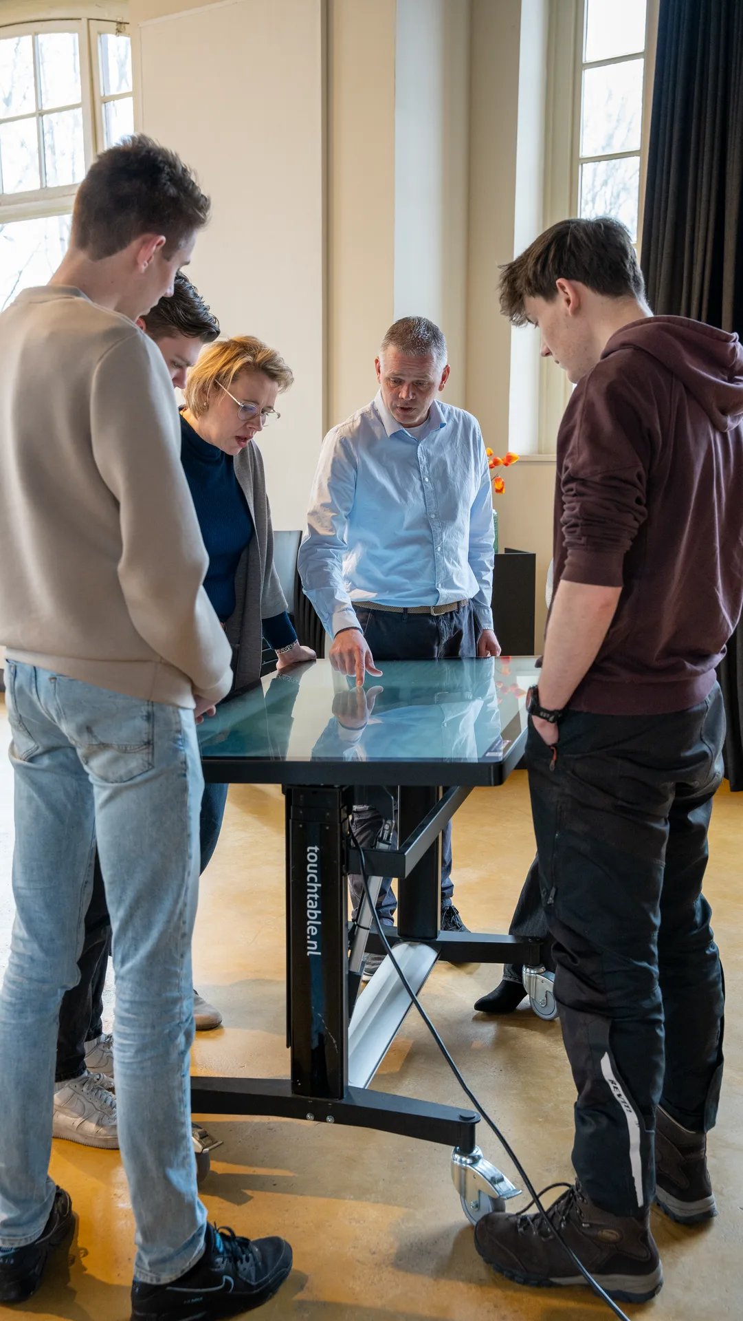
MapTalk Table
In-person participation with the MapTalk table
Use MapTalk on a large touchscreen table during consultation evenings, trade shows and presentations. Make participation visual and interactive.
Discover the MapTalk table


